DT-18
Delair · France · also known as DT18, DT18 HD, DT18 AG, Delair-Tech DT18 · Updated
The DT-18 is a small electric fixed-wing mapping and inspection UAV built by the French manufacturer Delair, and in September 2012 it received the first beyond-visual-line-of-sight certificate issued by France's civil aviation authority. With a 1.8 m wingspan and a 2 kg flying weight, it was designed for long corridor surveys of power lines, pipelines, railways and farmland.
Overview
Delair was founded in 2011 in Toulouse as Delair-Tech and built its early business around long-range fixed-wing aircraft for industrial survey work. The DT-18 was the platform that established that position. In September 2012 France's Direction générale de l'aviation civile granted it a beyond-visual-line-of-sight certificate, which Delair describes as the first such approval worldwide for a civilian unmanned aircraft. The type later held French S4 certification, and in June 2017 the public procurement agency UGAP selected Delair as national supplier of fixed-wing drones to French government agencies.
Design and capabilities
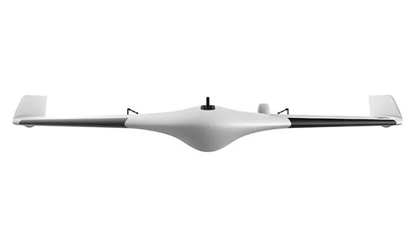
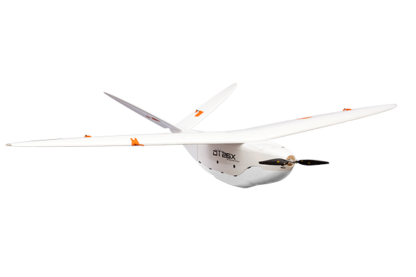
The airframe is a composite structure of fibreglass, carbon and Kevlar, 1.2 m long with a 1.8 m span and a flying weight of 2 kg including payload. It launches by hand or from a catapult and recovers by belly landing into an area of roughly 10 by 20 m, with Delair quoting a five-minute set-up. Propulsion is electric, from a single 8900 mAh lithium-polymer battery turning a folding propeller. Cruise speed is given as 61 km/h and wind resistance as 50 km/h; Delair does not publish a maximum airspeed, so that field is left empty here.
Command and control uses 869 MHz and 902 to 928 MHz links with AES-128 or AES-256 encryption, a 2.4 GHz datalink and an independent safety link. A 3G and 4G cellular option extended operations beyond radio coverage. Two antenna configurations were offered, giving 6.5 km or 20 km of command-and-control range. Navigation is GPS-based with Glonass and Galileo available, and dual-band PPK or RTK options quoted at 1.5 to 2 cm.
Sensor fits included a 21.4-megapixel global-shutter RGB camera on the DT18 HD and PPK versions, and a MicaSense RedEdge five-band multispectral camera on the DT18 AG for agronomy. Imagery fed Delair's own processing stack and exported to ArcGIS, QGIS, ENVI, AutoCAD, PLS-CADD and Surpac.
Two figures should be read carefully. The 100 km range quoted above is flight range per sortie, covering up to about 20 km² of ground; it is not datalink range, which is the separate 6.5 km or 20 km figure. Delair's own documents also differ on service ceiling, giving 2,500 m above sea level on the 2017 datasheets and 3,000 m on earlier material, with take-off and landing limited to 2,000 m. Endurance is quoted as up to 120 minutes on the datasheets and as a 90-minute average in the technical brief prepared for civil aviation authorities.
Documented use
Delair records the DT-18 flying power-line and vegetation inspection for the French distribution operator Enedis, and a 2017 beyond-visual-line-of-sight power-line programme with Airbus Aerial in the US state of Georgia. Other documented applications are underground pipeline inspection, railway and road corridor survey, mining and quarry volumetrics, topographic survey, precision agriculture and emergency response. Delair stated the type had accumulated more than 150,000 km of flight by 2016.
Status
The DT-18 no longer appears in Delair's current catalogue, which lists the UX11, the DT26 line, the DT46, the DT61 and the SEASAM underwater vehicle. The former DT18 HD product URL now serves the UX11 page, and the UX11 occupies the same compact mapping role. Delair has not published a formal end-of-production statement, so the status field here is left as unknown rather than asserting a retirement date.
Frequently asked questions
Who makes the DT-18?
Delair, formerly Delair-Tech, a French unmanned aircraft manufacturer founded in Toulouse in 2011.
How long can the DT-18 stay airborne?
Delair's datasheets give up to 120 minutes; the brief written for civil aviation authorities cites a 90-minute average.
How far can the DT-18 fly?
Up to 100 km per flight, covering around 20 km² of ground. The command-and-control link itself reaches 6.5 km or 20 km depending on the antenna fitted.
What is the DT-18 used for?
Aerial mapping and survey, power-line and pipeline inspection, rail and road corridors, mining, precision agriculture and emergency response.
Is the DT-18 still available?
It is no longer listed in Delair's catalogue, and the UX11 now fills the compact mapping role.
Was the DT-18 approved to fly beyond visual line of sight?
Yes. France's DGAC issued a beyond-visual-line-of-sight certificate in September 2012, and the type later held French S4 certification.