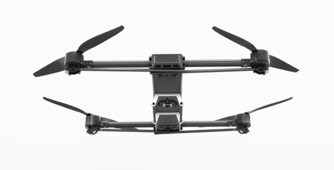
Quantix Mapper Hybrid VTOL
DraganFly · Canada · also known as AeroVironment Quantix Mapper, Quantix Mapper · Updated

Quantix Mapper is a hybrid vertical take-off and landing (VTOL) mapping drone designed and manufactured by AeroVironment, distributed commercially worldwide by DraganFly of Canada under an exclusive agreement announced in March 2020. It is built for aerial survey and mapping work such as agriculture, construction and infrastructure monitoring.
Overview
DroneLife reported in March 2020 that AeroVironment — a US company better known for tactical military drones — struck an exclusive worldwide distribution partnership with DraganFly to sell the Quantix Mapper into commercial markets. DraganFly had previously provided AeroVironment with contract engineering services on defence projects, and the companies said DraganFly could also support development of future Quantix versions. DraganFly COO Patrick Imbasciani described Quantix Mapper as filling a gap in DraganFly's own product line for a "medium sized commercial aircraft" aimed at mapping and surveying.
In October 2020, DroneDJ reported that Transport Canada had accepted the Quantix Mapper's safety assurance declaration for Advanced Operations — covering flight in controlled airspace and closer-than-standard operation near bystanders — making it, at the time, the fifth DraganFly-marketed aircraft to receive that approval. DraganFly said it would expand the aircraft's availability through its international dealer network and direct-to-consumer sales following the approval.
Design and capabilities
Quantix Mapper is a tail-sitter: it takes off and lands vertically like a multirotor, then tilts into forward flight and cruises as a fixed-wing aircraft, which DroneLife reports lets it cover more ground per flight than a pure multirotor of similar size. DraganFly's COO noted that, unlike some fixed-wing mapping drones, Quantix Mapper does not belly-land, reducing the risk of damage to its sensors or airframe between flights. The aircraft carries built-in visual and multispectral sensors for simultaneous true-colour and vegetation-index imaging.
A built-in "Quick Look" feature processes a visual orthomosaic and an NDVI (normalised difference vegetation index) map in the field shortly after landing, without requiring a separate computer or internet connection, letting operators review coverage before leaving a site.
Use cases
AeroVironment and DraganFly market Quantix Mapper for precision agriculture, construction-site progress monitoring, and other survey and mapping work where a single aircraft needs to combine vertical launch and recovery — useful in confined or obstructed sites — with the longer-range efficiency of fixed-wing cruise flight. Its Transport Canada Advanced Operations approval supports use in controlled airspace and closer to people than Canada's standard VTOL rules otherwise allow.
Frequently asked questions
Who makes the Quantix Mapper?
AeroVironment designs and manufactures it; DraganFly has held the exclusive worldwide commercial distribution rights since March 2020.
How does Quantix Mapper take off and land?
Vertically, like a multirotor — it is a tail-sitter that then transitions into forward flight and cruises as a fixed-wing aircraft, and it does not belly-land.
What sensors does it carry?
Built-in visual and multispectral sensors, with an onboard "Quick Look" feature that produces a visual orthomosaic and an NDVI map shortly after landing.
Is Quantix Mapper approved for commercial use in Canada?
Yes — Transport Canada accepted its safety assurance declaration for Advanced Operations in October 2020, covering controlled airspace and reduced-distance operation near bystanders.
What is Quantix Mapper used for?
Aerial survey and mapping work such as precision agriculture and construction-site monitoring, combining VTOL launch and recovery with fixed-wing cruise efficiency.