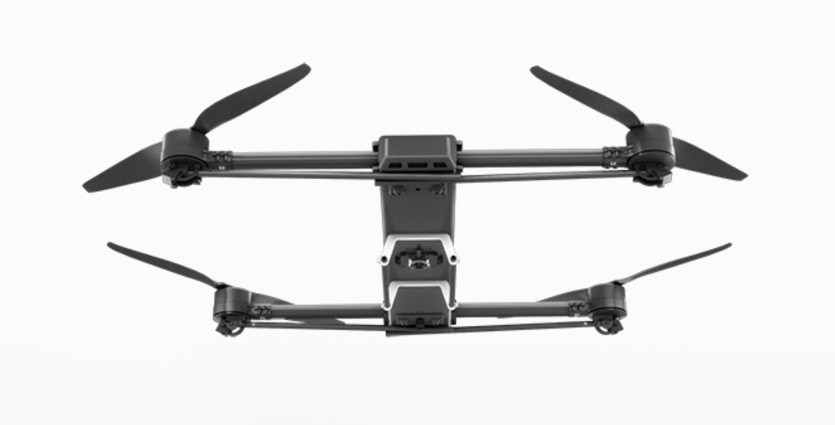
ZenaDrone IQ Quad
The ZenaDrone IQ Quad is an autonomous VTOL survey and mapping drone developed by ZenaDrone, a Canadian subsidiary of Nasdaq-listed ZenaTech, announced on 20 January 2026. It is a field-deployable quadcopter aimed at land survey, construction, urban planning and public-works customers, and forms part of ZenaTech's wider Drone-as-a-Service offering.
Overview
ZenaTech announced the IQ Quad on 20 January 2026 as a purpose-built survey and mapping platform, positioning it to support growth in the land survey, construction, urban planning and public-works markets. ZenaDrone describes it as a "field deployable enterprise quadcopter-design drone" intended to produce professional-grade land maps and 3D terrain models for surveying, infrastructure and development projects. The aircraft is sold and operated as part of ZenaTech's Drone-as-a-Service fleet model rather than purely as a standalone product.
Design and capabilities
The IQ Quad is a quadcopter with a weather-resistant carbon-fibre airframe and folding arms for portability and storage, with retractable landing gear intended to improve aerodynamics and keep its sensors unobstructed. ZenaDrone states a payload capacity of 2 to 3 kg, adaptable to interchangeable survey equipment including 4K cameras, LiDAR, multispectral sensors and thermal sensors, plus 360-degree situational-awareness cameras. The company gives a flight endurance of up to 45 minutes and a maximum operational range of 5 km before the aircraft must recharge. The drone recharges autonomously by landing on a dedicated charging station, and ZenaDrone lists real-time GPS navigation, obstacle detection and avoidance, and terrain-following among its safety features, together with an integrated cellular data link for real-time data transfer. Outputs include geo-tagged orthomosaic maps, cadastral and boundary maps, digital elevation, terrain and surface models, high-resolution video and photos, and textured 3D mesh models.
Use cases
ZenaTech markets the IQ Quad for land surveying and mapping across construction and earthworks, urban planning, mining, and golf-course and racecourse management. The aircraft is offered through ZenaTech's Drone-as-a-Service model alongside the company's enterprise mapping software, rather than sold only as standalone hardware.
Frequently asked questions
What is the ZenaDrone IQ Quad?
It is an autonomous VTOL quadcopter built by ZenaDrone for land survey and mapping work, announced in January 2026.
How long can it fly?
ZenaDrone states an endurance of up to 45 minutes and a maximum range of 5 km before recharging.
What payload can it carry?
ZenaDrone lists a payload capacity of 2 to 3 kg, covering interchangeable 4K, LiDAR, multispectral and thermal sensors.
What is it used for?
Land surveying and mapping for construction, urban planning, mining, and golf-course and racecourse management.
Who makes the IQ Quad?
ZenaDrone, a drone subsidiary of the Nasdaq-listed company ZenaTech, Inc.